Campeche Mexico Facts
According to 2010 census, the total population was 822,441 inhabitants, with a life expectancy of 74 years, crude death rate of 4.6 and 89.5% literacy.
Geographically, Campeche is located between the Guatemalan tropical rainforest of Peten and dry low forests of the northern end of the Yucatan Peninsula. It has an area of 200 km2 of rivers, consisting of five major rivers, with 7 hydrological basins and 2,200 km2 of coastal lagoons, with a variety of marine species.
The relief is generally flat, has a maximum height of 300 meters above sea level and slopes vary up to 15%. In the southeast, it is located the highest part of the relief, near Guatemala and Quintana Roo, with the highest elevations near Zoh Lagoon. Among the main highs, it can be found the Cerro Champerico, with 390 mt of altitude, the Cerro los Chinos with 370 mt, Cerro el Ramonal with 340 mt, and the Cerro el Gavilan, at 210 mt. Descending towards the lower parts of the central and western territory, the land forms steps, which gives the characteristics of a low plateau for its large areas of nearly flat surfaces.
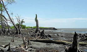
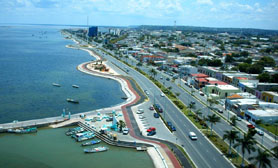
The coast of Campeche is 523.3 km long, for its variety of landscapes it has become an ideal area to enjoy various tourist activities. The North coastline consists of a strip of mangroves while the South coast is arid, with wooded hills forming beautiful ledges and coves. In the municipalities of Champotón and Carmen, it is formed a sandy strip, which has beaches of great importance, because there inhabit various species of sea turtles.
The Mexican State has a good infrastructure of ports, airports, road network, telecommunication and electric power, with adequate water availability and drainage.
Welcome to Campeche in Mexico!
The state of Campeche is located in southeast Mexico, on the west side of the Yucatan Peninsula. Campeche is just one of over 60 official online guides covering the whole of Mexico. If you´re planning a trip to Mexico and would like discover our fabulous nation before visiting or, if you´d like to visit a specific place in Mexico, then you´ve come to the right place.
The territory is 56,858.84km2, which is 2.6% of Mexico’s total. It borders the states of Yucatán, Quintana Roo and Tabasco, with the country of Guatemala to the south, Belize to the east and the Gulf of Mexico to the west. The south border is the the Petén department of Guatemala. The state capital, also called Campeche, declared a World Heritage Site in 1997 due to its numerous historical landmarks. Campeche is one of Mexico´s most popular places, visited by millions of people over the last decade. When you travel to Campeche you may wish to check out the Campeche hotels we have available or maybe you´d like to rent a car in Campeche? We also offer extensive day trips in Campeche. This unique place has simply amazing. We´ve also compiled a list of Travel books on Campeche Mexico. The creation of the state began with the city, which was founded in 1540 as the Spanish began the conquest of the Yucatán Peninsula. Throughout the colonial period, the city was a rich and important port, but declined after Mexico’s Independence. Campeche was part of the province of Yucatán but was divided from Yucatan in the mid-19th century, mostly because of political friction with city of Mérida.
Today, much of the state’s economy is based upon the finding of petroleum offshore in the 1970s, which has made the coastal cities of Campeche and Ciudad Del Carmen important economic hubs. Campeche is one of Mexico´s most popular places, visited by millions of people over the last decade. When you travel to Campeche you may wish to check out the Campeche hotels we have available or maybe you´d like to rent a car in Campeche? We also offer extensive day trips in Campeche. This unique place has simply amazing. We´ve also compiled a list of Travel books on Campeche Mexico. The state has significant Mayan and colonial sites but they are not as well known or visited as others in the Yucatán but are popular with enthusiasts willing to travel away from the tourist areas of Yucatan.
Whether you are visiting Campeche in Mexico for business, pleasure or both, we´re sure that Campeche will meet all of your expectations and that the people of Campeche will make you feel welcome while sampling some of the unique cuisine on offer in the Campeche Restaurant districts.
Things to see Campeche
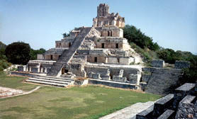
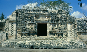
Much of Campeche’s territory is filled with various archeological sites, almost all of which are Mayan. An early important site is Edzna, located near the city of Campeche in a region known as los Chenes. These sites are far less known and visited than sites to the east such as Chichen Itza, Uxmal and Tulum. It was one of the most important ceremonial centers in the pre Classic Maya period (300-900CE). It is located away from other Mayan settlements on the peninsula and was probably a collection center for the agriculture products grown in the area, reaching its height between 600 and 900 it was discovered in the 1920s and excavated in the 1940s. During the planting season in early May, archeologist Antonio Benavides noticed that the setting sun illuminates a stucco mask hanging one of the pyramid’s rooms. The effect also happens in August, during harvest and it is believed to be related to the asking and receiving of abundant crops. These were sent to the city of Tikal in exchange for ritualistic adornment for the site. Its most important building is the Pyramid of the Five Stories, built as its name implies. Another important find came in the 1990s.
The Isla de Jaina is one of the best preserved archeological sites in the state because of its location on an island on the coast, surrounded by estuaries and mangroves. While most sites are in the interior rainforest of the state, there are fifty five archeological sites on the coast alone, mostly remnants of small villages. These other sites include Can-mayab-mul in Nunkiní, Xculhoc in Hecelchakán, Chunan-tunich, Xtampak, Hochob, Pak-chén and Dzebilnocac in Hopelchén, El Tigre in Candelaria, La Xoch and Chun Cedro in Tenabo and Becán in Calakmul. It requires special permission to visit.
Campeche Museums, Historic Buildings & Haciendas
Campeche’s historic buildings are protected by decree to keep them from being destroyed or altered by the growth of the city. Campeche is one of the least known and unrated colonial cities in Mexico, mostly bypassed by those visiting more famous destinations in the Yucatan peninsula. Campeche was one of the most important ports in New Spain.
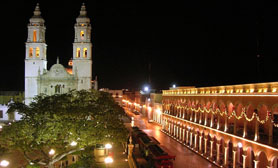
Campeche has a number of colonial era churches like the Asunción church in Dzitbalché was constructed in the 18th century, with a pointed arch doorway, choral window and bell-gable. The Guadalupe Church in Bécal, Calkiní was built in the 18th century. The San Diego Apóstol Church in Nunkiní, Calkiní was built in the late 16th and early 17th centuries. The Cathedral of Campeche is from the 16th century. Its façade is of worked stone with two levels marked off by two grooved pilasters. The San Francisco Church in Campeche was established in the 16th century although the current building dates from the 17th. The church and former monastery of San Luis Obispo is located in Calkiní, built in the 17th century of stone, wood and metal over a former Mayan temple. The facade is simple with a bell-gable and there remains only one of its original Baroque altarpieces, which was made in the 16th century. The church marks the spot where the first mass was held on mainland America. Most of the state’s colonial era churches are located in and near the city of Campeche, with some in Ciudad del Carmen. The Sagrado Corazón de Jesús Church was built in the 18th century in Sabancuy, Carmen. The church and former monastery of San Francisco de Asís was begun in the 16th century by the Franciscans in Hecelchakán. The Nuestra Señora del Carmen Church in Ciudad del Carmen was built in the 18th century.
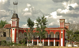
Outside of the city of Campeche, much of the notable civil architecture in the state is found on the various former haciendas. Many of these haciendas have been turned into hotels, spas and other tourist attractions. Hacienda Blanca Flor is located in Hecelchakán outside Campeche. This hacienda was a site of one of the bloodiest battles of the Caste War. Hacienda Santa Cruz is between Campeche and Calkiní in the Nunkiní community. It is dated to the middle of the 18th century established to raise cattle. It continued operating until the Mexican Revolution. Hacienda San José Carpizo is in the Champotón municipality, founded in 1871 by José María Carpizo Sánchez and was one of the most important on the Yucatán Peninsula, raising cattle. It survived the Mexican Revolution until its workers abandoned it in the 1940s. Hacienda San Luis Carpizo is located in Champotón and belonged to José María Carpizo, dedicated to agriculture. This hacienda was restored by the Mexican Army to house the Marine Infantry School in 1999. Hacienda Uayamón is near the city of Campeche with origins in the 16th century. It was attacked and its owner killed in the raid by Laurens de Graaf in 1685. It continued to operate until the Mexican Revolution and today it is home to the Hotel de Gran Turismo. Hacienda Tankuché was dedicated to raising dyewood (palo de tinte) but changed later to henequen. Despite losing most of its land in the Revolution, its henequen mill continued to operate until the 1980s.
Notable museums in the state include the Del Carmen Archeological Museum, the Museo de las Estelas Mayas in Ciudad del Carmen and the Camino Real Archeological Museum in Hecelchakán. The Museo Fuerte de San Miguel is located on one of the Campeche’s old forts. The museum is dedicated to the state’s history. Opened in 2000, it is the newest and most modern of Campeche’s museums.
Campeche Flora & Fauna
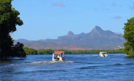
Laguna de Términos Mangroves, its brackish waters have developed a number of aquatic species such as sea bass, small sharks, crabs, oysters, turtles, and storks. The Laguna de Términos lagoon is located in the southwest of the state, near the Tabasco border. It is separated from the Gulf of Mexico only by the Isla del Carmen. It receives fresh water from most of Campeche’s rivers as well as salt water from the Gulf. The lagoon is ringed by smaller lakes and forms the most important lake-lagoon system in the country. This system formed about five thousand years ago by the accumulation of sediment carried by surrounding rivers. This system connects to the Sabancuy estuary to the northeast. These lakes include Atasta, Pom, Puerto Rico, El Este, Del Vapor, Del Corte, Pargos and Panlau.
Average annual rainfall varies between 900 and 2000 mm. Campeche is in the tropics with a humid climate with a defined rainy and relatively dry season from late winter to early spring. Average annual temperature is 26C with highs up to 36C in the summer and lows of 17C in the winter. The hottest and most humid areas of the state are along the coast between the Laguna de Términos and the northern border. In the winter, storms from the north called “nortes” can bring colder dry air from the area of the United States. In the late summer, there are sometimes hurricanes. Prevailing winds are from the northwest from November to March, from the north between September and October, from the southeast from June to August and from the south in April and May.
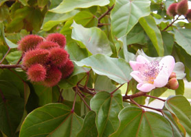
Campeche has large expanses of mangroves which dominate the swamps. Non swamp areas are dominated by palm trees. Wildlife is dominated by bird and reptile species such as storks, pelicans, ducks, seagulls, lizards, turtles and water snakes. The Mountain region is in the north and east of the state consisting of two chains of low hills called the Dzibalchen and Sierra Alta. The state has a number of ecosystems, from rainforest, to savanna to coast and sea. Environmentally, the state is divided into four major regions. The coast region consists of the entire coastline of the state and a strip of shallow water just offshore called the Sonda de Campeche with coral reefs and low islands called cays. It also includes the savannah area and an area called Los Chenes, where natural wells called cenotes are common. This area is noted for its tropical hardwoods and the chicle or gum tree. Many of the plants used in the state’s cuisine such as achiote and tropical fruits are from here. This area is under threat due to over exploitation. The River region is located in the southwest of the state, named after the various rivers that flow here, mostly emptying into the Laguna de Términos. It has the hottest and most humid climate in Campeche with wildlife and vegetation similar to that found in both the Rainforest and Coast regions. Wildlife includes deer, armadillos, rabbits, quail, and woodpeckers. The Rainforest region is located on the center and south of the state with a wide variety of trees including tropical hardwoods such as mahogany.
Campeche´s protected areas are: The Laguna de Términos Reserve, Calakmul Biosphere Reserve and the Los Petenes Biosphere Reserve with total an area of 1,810,597 hectares. The Laguna de Términos Reserve includes the lagoon and the area surrounding it with an area of 705,017 hectares. The Calakmul Reserve was created in 1989 over 723,185 hectares. It consists of Yucatán and Tehuantepec moist forests, containing high and medium growth semi-deciduous forests and seasonally flooded low height semi-deciduous forests. It was established in 1994. The wildlife is dependent on a varied and complex system of fresh and brackish water. The reserve extends over 382 hectares in the municipalities of Campeche, Tenabo, Hecelchakan and Calkini. Los Petenes is a natural reserve consisting of isolated pockets of rainforest with mangrove areas in between.
Main Campeche Flora. Ceiba pentandra, Enterolobium cyclocarpum, Mangle, Haematoxylum campechianum, Bixa orellana.
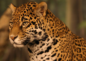
Main Campeche Fauna. Trichechus, Mazama americana, Eretmochelys imbricata, Crax rubra, Caiman, Panthera onca, Meleagris ocellata, Stenella, Leopardus pardalis, Boa constrictor.
Campeche | Miguel Colorado of Cenote
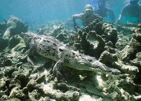
Away from the coast, these rainforests are interspersed with savannah areas and along the coast are accompanied by areas with sand dunes, mangrove wetlands and estuaries. Rainforest areas subdivide into a number of types which include perennial tall tree rainforest, semi perennial tall tree rainforest, deciduous medium height tree rainforest, semi deciduous medium height tree rainforest, deciduous low height tree rainforest and semi perennial low height tree rainforest. Plat and tree species that can be found in the various rainforests include huapaque, cedar (cedrela Mexicana), pukte (bucida buceras), sapote, dyewood (haematoxyllum campechianum), dzalam (lysiloma bohamensis) and more. Also known for a number of precious tropical hardwoods such as red cedar, mahogany, ciricote (cordia dodecandra) and (guialum sanctum) guayacán. Through the coastal areas, palms prevail such as the royal palm and coconut. The predominant wildlife species in the state are the ocelot, puma, deer, wild boar, jaguar, raccoon, hare, ring-tailed cat and spider monkey. There are many bird species including the ducks, quail, pelicans, chachalaca, toucan, buzzard and numerous others. Reptiles comprise of rattlesnakes, coral snakes, boa constrictors, various species of sea and land turtles, crocodiles and iguanas. Diving off the coast is in most of the state you´ll find abundant aquatic life including many species of fish, crustaceans and mollusks.
The rivers in the south and southwest belong to various basins, with the largest being the Grijalva-Usumacinta to which the Candelaria, Chumpán and Mamantal Rivers belong. Most of the state’s surface freshwater is in the south and southwest, with rivers, small lakes and estuaries. These diminish in the north where rainfall rapidly filtrates into the subsoil. The San Pedro River is another branch is the Usumacinta, which passes by the community of Jonuta in Tabasco before emptying in the Gulf. The Usumacinta also flows in the state but it tends to change course frequently and occasionally divides into branches. The east branch of this river is also called the Palizada River, which has the largest volume although it is narrow. The Chumpán River is an isolated river formed by the union of various streams. It runs north-south and empties in the Laguna de Terminos. The Mamantel River empties into the Laguna de Panlau. The Campotón River is in the center of the state and empties into the Gulf. The rest of the states streams flow only in the rainy season. The Candelaria River forms in Petén, Guatemala and runs north-south and empties into the Laguna de Pargos.
Geography Campeche Mexico
Campeche is a comparatively flat area of Mexico with approx 530 km of shoreline on the Gulf of Mexico. The majority of the surface is of sedimentary rock much of which is from marine or coral origin. The place with the highest elevations is near the borders with Guatemala and Quintana Roo regions. Notable mountainous areas include Cerro los Chinos (370 meters), Cerro Champerico (390 meters), Cerro El Ramonal (340 meters), Cerro El Doce (250 meters) and Cerro El Gavilán (210 meters). Yet, these hills are divided by large expanses of lower flat land. In Champotón to the south of the municipality begin a series of rolling hills known as the Sierra Alta or Puuc, which extend northeast to Bolonchen into the state of Yucatán, these being only an average altitude of between forty and sixty meters with some reaching 100 meters. There other areas of varying elevations, near the city of Campeche with prominent ones known as Boxol, Maxtum, El Morro and the Sierra Seybaplaya. Whether you are visiting Campeche in Mexico for business, pleasure or both, we´re sure that Campeche will meet all of your expectations and that the people of Campeche will make you feel welcome while sampling some of the unique cuisine on offer in the Campeche Restaurant districts.
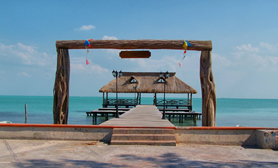
Campeche Isla Aguada Beach
Campeche Ecotourism includes caves such as Xculhoc, Chuncedro and Xtacumbilxuna’an or Mujer Escondida. The major beaches frequented by visitors are in the municipalities of Campeche, Champotón and Ciudad del Carmen. In Campeche, these beaches include Mar Azul, San Lorenzo and Playa Bonita. In Ciudad del Carmen, they include La Maniagua, Bahamita, Sabancuy, Playa Caracol also Playa Norte, Isla de Pájaros. In Champotón, they are Acapulquito, Costa Blanca, Payucán and Sihoplaya. In the interior of the state, there are a number of water parks such as El Remate in Tankuché and San Vicente Chuc-Say on a former hacienda of the same name. These generally take advantage of the local rivers, springs and cenotes.
Travelucion Guide Mexico Campeche | Free Guide Mexico
Campeche is just one of the websites Travelucion operates and is part of over 800 travel websites for over 130 countries worldwide. Our Mexico Collection of 70+ websites covers Mexican States, Cities and towns, along with 10 Mexico special interest websites. If you are traveling to Mexico, our websites will assist you in finding the right Mexican destination to suite your tastes and provide you with invaluable information before traveling to Mexico.
Acapulco is a city, municipality and major sea port in the state of Guerrero on the Pacific coast of Mexico, 300 kilometers (190 mi) southwest from Mexico City…Visit the official Acapulco travel Website
Aguascalientes is the municipal seat for the municipality of the same name and, the Aguascalientes includes the metropolitan area which includes the municipality of Jesus María y San Francisco de los Romo…Visit the official Aguascalientes travel Website
Baja California stands for “Lower California” it is one of the 31 states which, with the Federal District, comprise the 32 Federal Entities of Mexico. Baja California is both the northernmost and westernmost state of Mexico…Visit the official Baja California travel Website
Baja California Sur peninsula is bordered to the north by the state of Baja California and, to the west by the Pacific Ocean then to the east by the Gulf of California. The state has also shares maritime borders with Sonora and Sinaloa to the east from… Visit the official Baja California Sur travel Website
Cancun is a major world-renowned tourist destination, as well as being the seat of the municipality of Benito Juárez. Cancun is located on the Caribbean Sea, and is one of the easternmost points in Mexico… Visit the official Cancun travel Website
Chiapas is located in Southwestern Mexico; it is the southernmost State of Mexico. It is bordered by the states of Tabasco to the north, Veracruz to the northwest and Oaxaca to the west… Visit the official Chiapas travel Website
Chihuahua is located in Northwestern Mexico. It is bordered by the states of Sonora to the west, Sinaloa to the southwest, Durango to the south, and Coahuila to the east. To the north and northeast, it has a long line with the U.S.–Mexico border adjacent to the U.S. states of New Mexico and Texas…Visit the official Chihuahua travel Website
Coahuila borders the Mexican states of Nuevo León to the east, Zacatecas and San Luis Potosí to the south, and Durango and Chihuahua to the west. To the north, Coahuila accounts for a 512 kilometers (318 mi) stretch of the Mexico-United States border, adjacent to the U.S. state of Texas along the course of the Rio Grande… Visit the official Coahuila travel Website
Colima is a small state located in the Western Mexico region on Mexico’s central Pacific coast. It shares borders with the states of Jalisco and Michoacán. In addition to the capital city of Colima, the state’s main cities include Manzanillo and Tecomán. Despite being the fourth smallest entity in Mexico… Visit the official Colima travel Website
Comondú is a municipality of the Mexican state of Baja California Sur. This beautiful region is formed by old populations of missionary origin and it constitutes an oasis in the desert where small places of great natural and cultural richness arise. It is a very favorable area for developing alternative tourism… Visit the official Comondu travel Website
The island of Cozumel is about 48 km (30 mi) long and 16 km (9.9 mi) wide, and is Mexico’s largest Caribbean island. It is Mexico’s third-largest island, following Tiburon Island and Isla Angel de la Guarda. It lies some 10 km (6.2 mi) from the mainland, and 90 km (56 mi) south of Cancun… Visit the official Cozumel travel Website
Mexico DF was originally built on an island of Lake Texcoco by the Aztecs in 1325 as Tenochtitlan, which was almost completely destroyed in the 1521 siege of Tenochtitlan, and subsequently redesigned and rebuilt in accordance with the Spanish urban standards. In 1524…Visit the official Mexico DF travel Website
Durango is the fourth largest state in Mexico. The state is bordered to the north by Chihuahua, to the north-east by Coahuila, to the south-east by Zacatecas, to the south-west by Nayarit, and to the west by Sinaloa… Visit the official Durango travel Website
Ensenada is a coastal city in Mexico, the third-largest in Baja California. Located 125 kilometers (78 mi) south of San Diego on the Baja California Peninsula, it is locally referred to as La Cenicienta del Pacífico, “The Cinderella of the Pacific”… Visit the official Ensenada travel Website
Guanajuato is located in the North-Central Mexico. It is bordered by the states of Jalisco to the west, Zacatecas to the northwest, San Luis Potosí to the north, Querétaro to the east and Michoacán to the south. It covers an area of 30,608 km²… Visit the official Guanajuato travel Website
The state of Guerrero was named after Vicente Guerrero, one of the most prominent leaders in the Mexican War of Independence and the second President of Mexico. It is the only Mexican state named after a president. The modern entity did not exist until 1849, when it was carved out of territories from the states of Mexico, Puebla and Michoacán… Visit the official Guerrero travel Website
Hidalgo is located in Eastern Mexico. Hidalgo is bordered by San Luis Potosí and Veracruz on the north, Puebla on the east, Tlaxcala and México on the south and Querétaro on the west… Visit the official Hidalgo travel Website
Bahias de Huatulco is divided into four main districts. Tangolunda is the area where the large upscale resorts are located; Santa Cruz is a small town with the main marina and Santa Cruz beach; La Crucecita, is another small town just inland from the beach area which… Visit the official Huatulco travel Website
Ixtapa is a beach resort in the municipality of Zihuatanejo de Azueta, in the Mexican state of Guerrero. It is located 5 km (3.1 mi) to the northwest of the municipal seat, Zihuatanejo, and some 245 km (152 mi) northwest of Acapulco… Visit the official Ixtapa travel Website
Jalisco is one of the more important states in Mexico because of its natural resources as well as its history. Many of the characteristic traits of Mexican culture, particularly outside Mexico, are originally from Jalisco… Visit the official Jalisco travel Website
La Paz was founded by Hernán Cortés in 1535 and named Bay of Santa Cruz, though afterwards, the admiral Sebastián Vizcaíno baptized it as La Paz in 1596, currently the capital city of the state of Baja California Sur… Visit the official La Paz travel Website
Loreto is now a tourist resort, catering mostly to U.S. travelers, with daily flights from the U.S. state of California to Loreto International Airport. Many American tourists enjoy fishing in “pangas” for “dorado” Mahi-mahi or Dolphin Fish. Local restaurants will willingly prepare the daily catch of the tourists… Visit the official Loreto travel Website
Los Cabos is the tip of Baja California Sur. Wondering why they call it a dual destination? Part of the fun comes with exploring the region’s two dramatically distinct personas. Tranquil San Jose del Cabo retains the look and vibe of an authentic Mexican town… Visit the official Los Cabos travel Website
Manzanillo is well known internationally for deep-sea fishing and the green flash phenomenon during sunsets, as well as the warm waters of the ocean. The city is a destination resort and has many hotels and self-contained resorts, particularly built on the De Santiago peninsula… Visit the official Manzanillo travel Website
Mayakoba began as a vision; a dream inspired by its blue skies and its emerald beauty defining a ‘once in a lifetime destination in the Riviera Maya. A group of talented biologists, architects and designers persisted in the preservation of the flora and fauna of Mayakoba resort surrounded of sweet water lagoons… Visit the official Mayakoba travel Website
Mazatlan is a city in the Mexican state of Sinaloa. The city serves as the municipal seat for the surrounding municipio, known as the Mazatlan Municipality. Mazatlán was well regarded by film stars such as John Wayne, Gary Cooper, John Huston, and others of their generation as a sport fishing Mecca… Visit the official Mazatlan travel Website
Merida is a cultural center, featuring multiple museums, art galleries, restaurants, movie theatres and shops. Mérida retains an abundance of beautiful colonial buildings and is a vibrant cultural center with music… Visit the official Merida travel Website
Mexicali is one of most racially diverse cities in all of Mexico. The biggest festival in the region, the Fiesta del Sol (Festival of the Sun) is held each year starting at the end of September and continuing through mid-October. Popular dances and music provide a festive… Visit the official Mexicali travel Website
Mexico City´s Centro Historico is where it all began. Historic city center that is focused around the Zócalo or Plaza de la Constitución. The Zocalo is the largest square in Latin America and the third largest in the world after Moscow’s Red Square and Beijing’s Tiananmen Square… Visit the official Mexico City travel Website
Michoacan, formally Michoacán de Ocampo, its tourism board has divided the state into regions, mostly based on the major cities of Morelia, Uruapan, Lázaro Cárdenas, Patzcuaro, Zamora and Zitácuaro… Visit the official Michoacan travel Website
Morelos State of Mexico has rich cultural traditions and well preserved at museums across the state. Notable museums include the Museo Cuauhnahuac (the oldest civilian building in Mexico) as well as the Museo Robert Brady, named after an American art collector who fell in love with Cuernavaca in 1959… Visit the official Morelos travel Website
Mulege is a beautiful oasis town located along the tranquil shores of the Sea of Cortez. This small town enjoys a typical mild Baja climate that many travelers find to be exactly what they are seeking. Many of the campgrounds and RV… Visit the official Mulege travel Website
Nayarit is located in Western Mexico. It is bordered by the states of Sinaloa to the northwest, Durango to the north, Zacatecas to the northeast and Jalisco to the south. Tourism is increasing and Nayarit’s coastline is still relatively undeveloped, enabling visitors to surf and swim on beautiful, un-crowded beaches… Visit the official Nayarit travel Website
Nuevo Leon ranks above all Latin American countries in the Human Development Index. With world leading companies such as Cemex, Bimbo, Maseca, Banorte, ALFA Ternium, i-service, Vitro SA, Coca-Cola, and Cervecería Sol, Tecate, Bohemia, Indio and Nochebuena are just but a few multinationals located in Nuevo Leon… Visit the official Nuevo Leon travel Website
Oaxaca is also incredibly important to Mexico’s food traditions being the birthplace of the “mole,” a very popular Mexican sauce that is used in many traditional cuisines. Culture and history are rich in the Oaxaca region. Ruins from the ancient tribes that used to inhabit the region are plentiful, as are museums that celebrate the history of the region… Visit the official Oaxaca travel Website
Playa del Carmen is a city located along the Caribbean Sea in the state of Quintana Roo in Mexico. Locally known as just “Playa”, has undergone rapid development over the past few years with many new luxury residential condominium buildings, restaurants, boutiques and entertainment centers. Currently there are plans to develop over 10 luxury boutique hotels. World renowned chain restaurants including PF Changs, Hard Rock Cafe, Ruth’s Chris, the Cheesecake Factory a but just a few… Visit the official Playa del Carmen travel Website
Rosarito, Baja California is located 20 minutes south of the border from San Diego, California, this proximity to the border and scenic location between the Pacific Ocean and coastal foothills, makes Rosarito Beach (or Playas de Rosarito) one of the leading resort towns in Baja California… Visit the official Rosarito travel Website
Puebla City and State, formally Puebla de los Ángeles, is one of the five most important Spanish colonial cities in Mexico. The historical and cultural value of Puebla’s architecture is a major reason the city was chosen as a World Heritage Site. Various styles and techniques such as Baroque, Renaissance and Classic are represented here in over 5,000 buildings… Visit the official Puebla travel Website
Puerto Vallarta is a city and popular vacation resort on the Pacific Coast of Mexico. Around its coastal bay lie beautiful beaches, lush jungles and sparkling waterfalls offer many options for the adventurous travelers, while five star resorts, world-class shopping and gourmet restaurants satisfy even the most sophisticated traveler. Stretching from the south end of Old Town to central downtown… Visit the official Puerto Vallarta travel Website
Queretaro is located in North-Central Mexico, in a region known as Bajío, bordered by the states of San Luis Potosí to the north, Guanajuato to the west, Hidalgo to the east, and Michoacán to the southwest. The Centro Histórico is a UNESCO World Heritage Site and includes the Cerro del Sangremal, crowned by the Convent of the Holy Cross and the flat area on the east that extends into the Cerro de las Campanas… Visit the official Queretaro travel Website
Quintana Roo is located in Southeastern Mexico, on the Yucatán Peninsula, bordered by Campeche to the west. To the north, Quintana Roo borders the Gulf of Mexico and to the south, Belize and a small border with Guatemala. Quintana Roo is home of the world famous city of Cancun, the islands of Cozumel and Isla Mujeres, the towns of Bacalar, Playa del Carmen and Akumal, as well as the ancient Maya ruins of Chacchoben, Coba, Kohunlich, Muyil, Tulum, Xel-Há, and Xcaret… Visit the official Quintana Roo travel Website
Riviera Maya or the Mayan Riviera, is a tourism destination following the coastal Highway 307 which parallels the Caribbean coastline of the Mexican state of Quintana Roo, located on the eastern portion of the Yucatán Peninsula. Tourism started at the city of Playa del Carmen and ended at the village of Tulum, although the towns of Puerto Morelos situated to the north and between Playa del Carmen and Cancun as well as the town of Felipe Carrillo Puerto situated to the south of Tulum are both currently being promoted as part of the Riviera Maya tourist corridor… Visit the official Riviera Maya travel Website
San Luis Potosi stretches across the windswept, sun-baked plains of north central Mexico. It is one of Mexico’s most picturesque towns, whose central historic center features tiered esplanades, several handsome plazas, flower-filled parks, and an active cultural scene. Its importance in Mexican history spans four centuries of influence, making its capital city of the same name a fascinating destination… Visit the official San Luis Potosi travel Website
Sinaloa is located in Northwestern Mexico. It is bordered by the states of Sonora to the north, Chihuahua and Durango to the east and Nayarit to the south. To the west, Sinaloa has a significant share of coastline on the Gulf of California… Visit the official Sinaloa travel Website
Sonora is a major tourist attraction due to its pristine beaches of; San Carlos, Puerto Peñasco, Bahía Kino, also the Gulf of Santa Clara in San Luis Río Colorado. San Carlos has a large variety of sea life off its shores, making it popular for sports fishing and scuba diving. One of its main attractions is the Playa de los Algodones, called such because its sand dunes look like cotton balls. Puerto Peñasco has no less than 110 kilometres (68 mi) of beaches, which have calm seas… Visit the official Sonora travel Website
Tabasco is home to ancient Mayan empire called Comalcalco. The city’s architecture is unique among Mayan sites in that brick was used in place of stone. Comalcalco’s ruins include three large ceremonial complexes: the Grand Acropólis, the North Group and the East Acrópolis. Due to the prominence of the Olmec culture in Tabasco, the state dedicated a museum, the Parque-Museo La Venta, to the Olmec civilization… Visit the official Tabasco travel Website
Tamaulipas is one-third the size of the state of Chihuahua and fifteen times larger than Morelos. The Tamaulipas International Festival is held each October, features cultural and artistic events that include exhibits, plays, concerts, and cinema. The Tampico Port in Tamaulipas is one of Mexico’s first exporting ports. While oil is the primary commodity exported from Tampico, it also ships silver, copper, lumber, wool, hemp… Visit the official Tamaulipas travel Website
Tecate is a small city in Baja California located on the border with California, United States in the San Diego and in Tijuana metropolitan area. There is a small port of entry between the cities that serves as a calmer alternative to the bustling port of Tijuana. The Tecate brewery is the centerpiece of the town and it stands out more than any other landmark in the city. They have been making beer here since 1943… Visit the official Tecate travel Website
Tijuana´s skyline is the third largest in Mexico and is located in the Zona Rio and Playas de Tijuana. In the Zona Rio the buildings are concentrated on the Tijuana River parallel to the river and on the edges of the Tijuana Country Club. In Playas the high-rises are currently focused on the coast… Visit the official Tijuana travel Website
Tlaxcala is Mexico’s smallest state, was once home to the ancient Olmeca and Xicalanca civilizations. Tlaxcala is home to three famous bullrings. The most famous being the Jorge “El Ranchero” Aguilar plaza, built in the 18th century in the heart of Tlaxcala City. Today it’s known for its farms and textile industries and tourism… Visit the official Tlaxcala travel Website
Veracruz is located in Eastern Mexico, bordered by the states of Tamaulipas to the north, San Luis Potosí and Hidalgo to the west, Puebla to the southwest, Oaxaca and Chiapas to the south and Tabasco to the southeast. Veracruz continues to be a very important part of Mexico’s economy. The state is rich in natural resources and represents approximately 35 percent of Mexico’s water supply… Visit the official Veracruz travel Website
Xcaret is a natural park that treasures the best of the traditions and culture of Mexico, a paradise that combines the natural beauty and cultural wealth of the country and the region. Located 45minutes from Cancun, Mexico, Riviera Maya, in Xcaret you will find underground rivers, natural pools and a myriad of attractions… Visit the Xcaret Park Website
Xelha is located south of the modern town of Playa del Carmen, in the state of Quintana Roo, Mexico. Xel-Ha is an ecological theme park or natural aquarium. Here you can swim with dolphins, see sea turtles, bicycle, snorkel, cliff-dive, and scuba. If you choose to scuba you will get to pet stingrays and see larger fish. This park is large, so bring good shoes to walk up river, you bag your dry belongings and they will be driven back to the main area… Visit the Xelha Park Website
Yucatan is located in Southeastern Mexico, on the north part of the Yucatán Peninsula. It is bordered by the states of Campeche to the southwest, Quintana Roo to the northeast and the Gulf of Mexico lies off its north coast. Home to the restored Mayan ruins of Chichén Itzá and the Pyramid of Kukulcán… Visit the official Yucatan travel Website
Zacatecas Colonial Center contains many notable structures, including the Plaza de Armas or Main Square with its magnificent stone façade. The Palacio de Gobierno, the Residencia de Gobernadores and Palacio de la Mala Noche (Palace of the Bad Night) are also located in the Center… Visit the official Zacatecas travel Website
Zihuatanejo evolved from a quaint fishing village to a backpackers’ hotspot, to today’s incarnation of winding streets of galleries and folk art shops, small boutique hotels and palapa-style seafood restaurants serving the fresh catch of the day. Backpackers still holiday in Zihuatanejo, but share the experience with honeymooners, snorkelers, swimmers, and cultural travelers who appreciate “Zihua’s” laid-back vibe and postcard-worthy scenery of rocky cliffs, sand and sea… Visit the official Zihuatanejo travel Website


