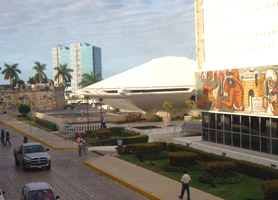
Campeche Mexico Facts
According to 2010 census, the total population was 822,441 inhabitants, with a life expectancy of 74 years, crude death rate of 4.6 and 89.5% literacy.
Geographically, Campeche is located between the Guatemalan tropical rainforest of Peten and dry low forests of the northern end of the Yucatan Peninsula. It has an area of 200 km2 of rivers, consisting of five major rivers, with 7 hydrological basins and 2,200 km2 of coastal lagoons, with a variety of marine species.
The relief is generally flat, has a maximum height of 300 meters above sea level and slopes vary up to 15%. In the southeast, it is located the highest part of the relief, near Guatemala and Quintana Roo, with the highest elevations near Zoh Lagoon. Among the main highs, it can be found the Cerro Champerico, with 390 mt of altitude, the Cerro los Chinos with 370 mt, Cerro el Ramonal with 340 mt, and the Cerro el Gavilan, at 210 mt. Descending towards the lower parts of the central and western territory, the land forms steps, which gives the characteristics of a low plateau for its large areas of nearly flat surfaces.
The coast of Campeche is 523.3 km long, for its variety of landscapes it has become an ideal area to enjoy various tourist activities. The North coastline consists of a strip of mangroves while the South coast is arid, with wooded hills forming beautiful ledges and coves. In the municipalities of Champotón and Carmen, it is formed a sandy strip, which has beaches of great importance, because there inhabit various species of sea turtles.
The Mexican State has a good infrastructure of ports, airports, road network, telecommunication and electric power, with adequate water availability and drainage.


